Ebay banner

Showing posts with label railway. Show all posts

Sunday, 7 January 2018

Wandering along the Camel Trail, Padstow, Cornwall

Here's another collection of pictures from one of our summer breaks. This one features photos taken along the former railway line, the Camel Trail, at Padstow, Cornwall.

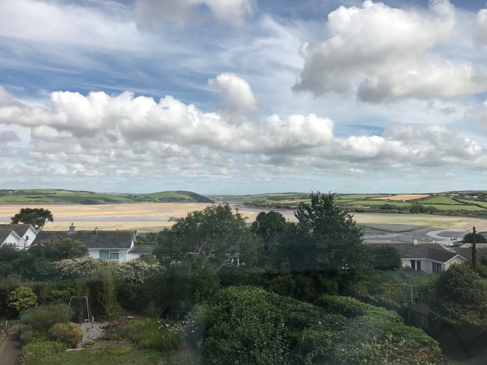
On arrival at our B&B we were greeted with this wonderful view of the Camel Estuary at very low tide, from the bedroom window. The Camel Trail is just the other side of the houses.

View from the B&B, overlooking the Camel Estuary, Cornwall

Camel Estuary from the Camel Trail, Padstow, Cornwall

The Camel Trail and Estuary, Padstow, Cornwall

Boats on the Camel Estuary from the Camel Trail, Padstow, Cornwall

Boats on the Camel Estuary from the Camel Trail, Padstow, Cornwall


Just outside Padstow is this wonderful iron bridge. Although sadly no longer carrying steam trains full of excited holiday-makers, or hauling trucks full of freshly caught fish, it has been converted into a recreational route for walkers and cyclists.

Iron bridge, Camel Trail, Padstow, Cornwall

The view from the bridge is quite stunning too.

Iron bridge, Camel Trail, Padstow, Cornwall

Iron bridge, Camel Trail, Padstow, Cornwall

Iron bridge, Camel Trail, Padstow, Cornwall

Iron bridge, Camel Trail, Padstow, Cornwall

The main reason for the bridge it would seem was to cross Little Petherick Creek.

Little Petherick Creek from the Camel Trail, Padstow, Cornwall

A little way outside Padstow beyond the iron bridge, at low tide the views both ways along the estuary open out into wide expanses of sand.

Camel Estuary from the Camel Trail, Padstow, Cornwall

Camel Estuary from the Camel Trail, Padstow, Cornwall

Camel Estuary from the Camel Trail, Padstow, Cornwall

Looking back towards the iron bridge on the Camel Trail, Padstow, Cornwall

Camel Estuary from the Camel Trail, Padstow, Cornwall


As usual, thanks for reading. Hopefully I'll get an opportunity for some more urban, suburban and coastal wandering over the coming weeks, with more posts to follow.

Friday, 29 December 2017

A Weekend Break in Bideford, Devon (cycling the Tarka trail from Bideford to Meeth, and back)

As mentioned a few posts ago, I have a wealth of material from earlier in the year which I didn't have time (at the time) to process and post, but with a few days on my hands before going back to work, and still trying to fight off the man-flu, it's about time I put that right. The first of these retrospective posts will focus on a weekend break we had in Devon, Bideford to be precise, and the first of the Bideford posts will focus on a cycle ride we did along the magnificent Tarka Trail, a former railway now converted into a quite wonderful cycle path.

I must however first start with a small apology. We actually did two rides along the Tarka Trail from Bideford. The first was south from Bideford, which is covered by the majority of the photos, but we also cycled north which for some reason only seems to have a few photos where I'm sure I took more. The apology is that I fear I may have mixed some of these up and am not sure of the location of all of them - I think these are all from the ride between Bideford and Meeth. I'm very clear on the first one however, this is the old bridge carrying the former railway into Bideford station.

Former railway bridge, now home to the Tarka Trail cycle path, Bideford, Devon
Former railway bridge, now home to the Tarka Trail cycle path, Bideford, Devon 

Tarka Trail cycle path, Bideford, Devon

Tarka Trail cycle path, Bideford, Devon

This next picture shows one of Bideford's two former railway stations. Although not very far from the main station, the Royal Hotel had its own station allowing guests easy access. Both platforms remain and are in reasonable condition, although the one opposite the hotel is a little overgrown.

The former Royal Hotel Station, Bideford, Devon
The former Royal Hotel Station, Bideford, Devon 

The former Royal Hotel Station, Bideford, Devon

This is Bideford station proper, parts of which have now been restored (see pictures further down in this post).

The former railway station, Bideford, Devon

Where parts of the railway has been preserved, there is some wonderful railwayana (is that a word). This is a restored but disused signal just south of Bideford. You can also just see some re-laid tracks in the foreground, but these peter-out before long and I think are only there to allow the carriages which house the museum and tea rooms to have somewhere to sit.

Restored but disused signal, Bideford, Devon

This is where things begin to get a bit blurred. This is definitely on the route south from Bideford to Meeth, but not sure exactly where. Still, it's another fine example of a disused platform.

Disused railway platform, Tarka Trail, somewhere south of Bideford

Along the side of the former track bed there were some wonderful Gaudi-like sculptures, depicting animals from Tarka the Otter.

Sculpture along the Tarka Trail, somewhere south of Bideford

Sculpture along the Tarka Trail, somewhere south of Bideford


Cycling the Tarka Trail, somewhere south of Bideford

Disused railway platform, Tarka Trail, somewhere south of Bideford

I'm pretty sure this is just outside Meeth, which was as far as we cycled south along the Tarka Trail.

Cycling the Tarka Trail, former railway platform just outside Meeth, Devon

There's no mistaking this one though. This is the truly wonderful Puffing Billy café, situated at the former Great Torrington station. It was so good that we stopped for a bacon sandwich on the outward ride in the morning, and again for a cream tea on the return leg. Good for railwayana fans and cream tea connoisseurs alike.

Cycling the Tarka Trail, Puffing Billy Trading Station, Great Torrington, Devon

Of all the picture I took during our 40 mile round trip, this one is probably my favourite. Ok, so it's a bit staged with the milk churns there for historical purposes only, but I felt it captured the essence of a branch line railway quite well. Nice sky too.

Cycling the Tarka Trail, milk churns at the former Bideford station

I managed to take a picture of the restored signal box on the same evening.

Cycling the Tarka Trail, restored signal box, Bideford, Devon

I think these final two pictures must have been taken on a different day as the weather and light are both quite different. They both however show the restored railway carriages sitting on some re-laid track in the former Bideford station. Inside the carriages are a museum and tea-room.

Cycling the Tarka Trail, Bideford station, Devon

Cycling the Tarka Trail, Bideford station, Devon

 I do have some more pictures of Bideford off the Tarka Trail so to speak, so I may get around to sharing those in the next few days.,


Once again, thanks for taking the time to read my post, I hope you enjoyed it. As usual, comments are always welcome and appreciated.
Friday, 8 December 2017

A Weekend Wandering Around Kent (part 4, in and around Margate station)

Hello everyone, thanks for returning. Today I'm back with the next instalment of my weekend wandering around Kent. I'm still working through the many pictures I have of Margate, so once again this post will cover Margate, specifically the area in and around the railway station. These pictures were taken on two different days as we made our way from Margate station to venture out to Whitstable on the sunny day, and Canterbury on the dreary day. Blog posts on those two day trips will follow.

First up we have a couple of wonderful ghost signs just outside the station car park. Both are for

ALBERT GARAGE
DOMINION MOTOR SPIRITS

with the one in the shade being in better condition as until relatively recently it would seem to have been protected from the weather as it was covered by a more modern advertising board.

Albert Garage, Dominion Motor Spirits, Ghost sign, Margate, Kent

The Shell sign on the front of the building was only partially complete. I now wished I had ventured up the alley to take a closer look and perhaps a clearer photo of it, but was worried about missing the train.

Albert Garage, Dominion Motor Spirits, Ghost sign, Margate, Kent

In compiling this latest blog post I now realise that I don't actually have any photos of the front of the station, which is a shame as it's quite a grand, grade II listed building. However what I do have are some pictures showing other aspects of the station's architecture.

The first couple of pictures show the former water tower at the east end of the station.

Water Tower, Margate Station, Kent

The square looking building to the left of the picture is the main entrance to the station, and once again apologies for not having any pictures of the front or the interior to share.

Water Tower, Margate Station, Kent

Platform Canopy, Margate Station, Kent

Dreamland from Margate Station, Kent
The Big Wheel at Dreamland from Margate Station, Kent

And so on to the second visit to the station, marred only by the dismal weather. When I first spotted this ghost sign I had not realised that the Albert Garage was in fact still an active operation just around the corner.

Albert Garage Ghost sign, Margate Station, Kent

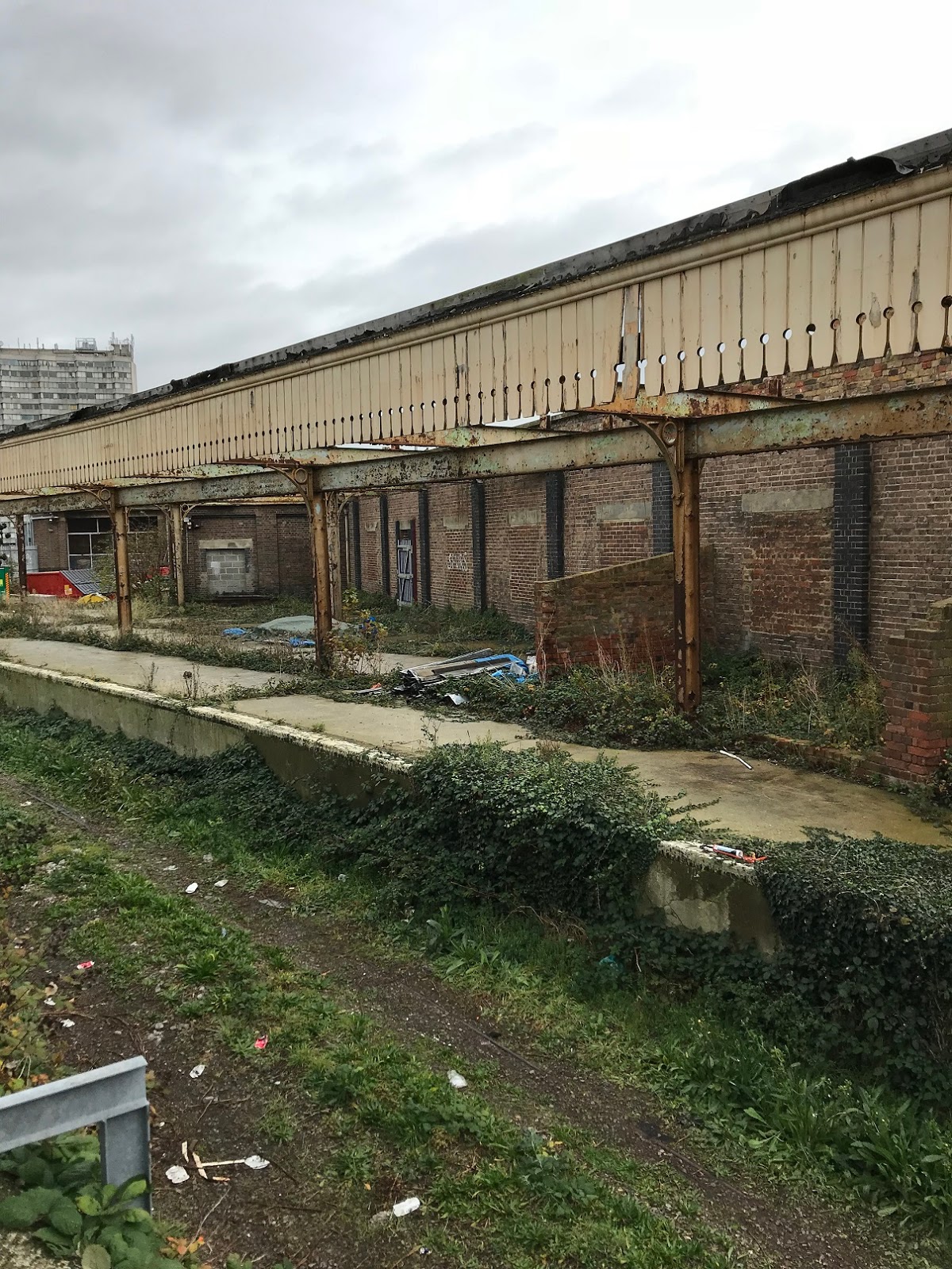
During the previous day's trip out of Margate on the train, I noticed some abandoned looking platforms to the side of the station. With a bit more time to spare before the train left I ventured beyond the confines of the station to see what these were. A bit of internet research revealed these to be a former parcels depot and sidings, of which some parts were more derelict than others.

Abandoned parcel depot and sidings, Margate station, Kent

Abandoned parcel depot and sidings, Margate station, Kent

Abandoned parcel depot and sidings, Margate station, Kent

Abandoned parcel depot and sidings, Margate station, Kent

Abandoned parcel depot and sidings, Margate station, Kent

Thanks for reading ... and so we come to the end of another Margate post, with probably just about enough material for one more. In case you missed the previous posts on Margate these can be found at a weekend wandering around Kent (part 2, Margate) and Margate again (from abandonment to Dreamland).


Friday, 10 November 2017

An Urban Wander around Brentford, London

Every time I think I'll devote some time to writing a new blog post I seem to get sidetracked. Most of the distractions are good and generally related to some of my favourite past times like mountain biking, walking, going to gigs, searching for vinyl records and reading ... which reminds me that I should mention my latest read before launching into today's post. Based on my enjoyment of Concretopia: A Journey Around the Rebuilding of Postwar Britain, by John Grindrod, and also based on my own childhood of growing up on the outskirts of London in the 1970's living on the edge of the greenbelt, I ordered another of his books, Outskirts: Living Life on the Edge of the Green Belt. 

The pictures in this post were taken a couple of months ago when I was staying up in London for work. My usual hotel near the office was priced well beyond the reach of any reasonable expenses policy, so I ended up staying a bit further out of the centre, in Brentford. I have driven past Brentford on the way into London in the past, but have never stopped and don't really know much about it, other than their football team has an annoying habit of beating my football team, but let's not dwell on that.

As I walked from the bus stop to my hotel for the night, I already suspected a different experience than my usual London overnight stay. The lane I took from the main road towards the hotel quickly became a footpath and cycle path, leaving the noise of the road behind and opening out into park land. As I approached the hotel I could see the dome of the Great Conservatory of Syon House, architected by Charles Fowler in the 1880s and restored to its former glory in the 1980s.

Great Conservatory, Syon House 

I'm assuming the turreted building was some sort of gate, or guard house, for the main house.


The actual house of Syon House, London home of the Duke of Northumberland, with grounds re-designed by Lancelot "Capability" Brown, looked wonderful in the late evening sun. Just a shame that there was a transit van parked outside to spoil the view.

Syon House in the late evening sun

The late evening sun and a liberal spread of light cloud, made for some great views and photo opportunities.

Late evening sun in Syon Park

After my evening stroll around Syon Park I headed into Brentford in search of dinner. I knew the Grand Union canal went through Brentford, but was not quite sure what to expect. Being a keen walker, and having walked on parts of the London Loop, the Grand Union Canal Walk, and the Capital Ring I was impressed by the available options on this sign ... almost a walker's paradise.

Walker's paradise signpost , Brentford Lock

Brentford lock itself remains an impressive engineering feature, but the residential areas around it left me a little cold.

Brentford lock
Brentford lock

Brentford lock
Brentford lock

There was however still some sign of industry of days-gone-by further down the canal.


I'm not quite sure what this building is, or was, or whether the ornate, floral metalwork was original, restored or new. Either way it made a pleasant change to the canal side flats.


This was not the first time I'd seen a mile post for Braunston. I had seen one previously during a Suburban Wander from Harefield to Moor Park following the London Loop where I had suggested it was "in the middle of nowhere" but was quickly and quite rightly corrected by a reader saying otherwise, so I won't make that mistake again.

Mile post for Braunston

The grade II former toll house is now a museum.

Former toll house, Brentford Lock

These next 2 photos were taken the following morning as I made my way back to the bus stop. I had seen the former railway bridge the previous night but it was too dark for a photo. These former railway arches used to carry the Brentford Branch Line, or Brentford Dock Line, from the GWR line at Southall down to Brentford Dock. The bridge across the road is long since gone, but the railway arches still remain, although a bit too orange for my liking. A bit of internet research suggests this line could be re-opened.

Railway arches carrying the former Brentford Dock line

Railway arches carrying the former Brentford Dock line

Here are a few links to some of the books and walks I referenced earlier on in the blog post.


Thanks for reading. Your comments are always welcome and appreciated. Hopefully my future posts will not be so few are far between.

Related Posts Plugin for WordPress, Blogger...