Ebay banner

Saturday, 27 January 2018

A lunchtime wander to West Brompton

Despite the grey skies, and menacing clouds, I braved the elements and ventured out. A round trip to West Brompton is just about possible within a lunch hour, and there are fortunately various routes to get there, so plenty of scope for wandering along new roads. I have previously visited West Brompton but I think only from the opposite direction.

London has plenty of Peabody housing, courtesy of social visionary George Peabody. As well as being architecturally striking, many have interesting signage. I'd like to have taken a few more pictures here but I felt I was intruding too much into people's personal space.

Signage on the Peabody houses, Lillie Road, London

Along the same stretch of road was a former school, with the segregated school entrance signs still visible. Just a few yards away from the Girls & Infants entrance was the Boys entrance.

Girls & Infants entrance to former school, Lillie Road, London

When I first saw this ghost sign, I had assumed that I'd seen it before, but then realised that the one I had seen was at the other end of Lillie Road. I can only assume I'd never spotted this massive one before as I had always walked in the opposite direction. Quite pleased with my find though.

Brymay safety matches ghost sign, Lillie Road, West Brompton, London

With the Empress State Building to the left, and the London Overground railway approaching West Brompton station to the right, this piece of open land is in the process of being redeveloped. I'm sure next time I visit it will look completely different.

Wasteland between Empress State Building and London Overground line, West Brompton

On my return route I spotted this ghost sign on Chesson Road. I am fairly sure I had walked this way before but never noticed it. On closer inspection though, the fact that the main part of the sign is a different colour to the rest of the walls suggests it has, until recently perhaps, been covered by a more modern billboard. Unfortunately I cannot make out what it says. Maybe the last word is Hall?

Ghost sign, Chesson Road, Fulham, London

As often seems to happen, when I'm out hunting for ghost signs, almost anything can look like one. I originally took this photo to showcase the boarded-up shop, but also noticed above the shop what could perhaps once have been a ghost sign. Having blown the picture up though, I now think I was imagining it.

Boarded-up shop, Turneville Road, London W14


Sunday, 21 January 2018

A lunchtime wander around Brackenbury Village, London

It's all too easy to allow work to overtake my intentions, and once again this has happened in terms of finding time to dedicate to this blog. Admittedly it's only a couple of weeks this time, unlike the months of absence I saw last year, but I had intended to blog at least weekly. Last week was manic at work, but fortunately I did manage to escape the office one lunchtime when I was up in London. I must have walked pretty much everywhere within a lunch time's walking distance from the office, so decided to re-visit somewhere I'd not been for a while ... Brackenbury. Brackenbury is essentially a London village, situated between Hammersmith and Ravenscourt Park. Despite being situated between some fairly major roads, it still has a village-like feel, although some of what I assume used to be village shops are now tastefully converted into residential or business premises, rather than being boarded-up and run down, which would almost certainly be the case in some of the neighbouring areas.

I've performed a quick internet search but couldn't find any information to suggest what these buildings used to be.

Brackenbury Village, London

They are however beautifully preserved, or should that be restored?

Brackenbury Village, London

Even the Christmas trees are stacked neatly, on a spotless street, awaiting collection.


Brackenbury Village, London

Brackenbury Village, London

This was the only building that I had any success in determining it's former purpose, which was apparently a bakery. I was hoping that what appears to be two ghost signs on the building would reveal more, but unfortunately any lettering is long gone.

Former bakery, Brackenbury Village, London

Ghost signs on the former bakery, Brackenbury Village, London
Continuing on my loop, to the eastern edge of Brackenbury, I came across again what I assume was a shop at one time, on Hammersmith Grove, with it's original sign maintained.


Former shop, Hammersmith Grove, Brackenbury Village, London

These lovely Hindustan Ambassadors were a surprise. Beautifully restores and now part of Karma Kabs.

Hindustan Ambassadors, Brackenbury Village, London

This building has all the signs of having been a pub, but again I can't find any information.

Former pub(?), Brackenbury Village, London

One of the striking features about Brackenbury Village was the tiling that many of the houses displayed.

Brackenbury Village, London

Now a pilates studio, I wonder what this building was previously. The ghost sign above the door is more readable than on the bakery but still not quite readable enough to be able to decipher.

Ghost sign, Brackenbury Village, London

Having spotted a few books on London Villages, I think I'll do some research over the next few remaining weeks of winter, and when the evenings become longer maybe start exploring some new places.


Thanks, as always, for reading. Comments welcome and appreciated.


Sunday, 7 January 2018

Wandering along the Camel Trail, Padstow, Cornwall

Here's another collection of pictures from one of our summer breaks. This one features photos taken along the former railway line, the Camel Trail, at Padstow, Cornwall.

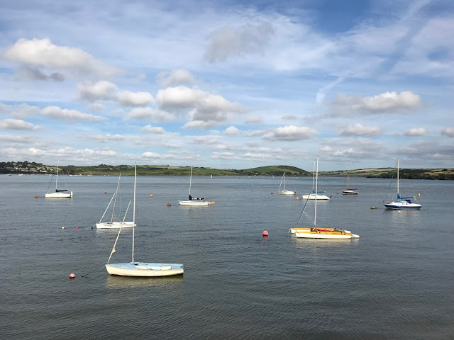
On arrival at our B&B we were greeted with this wonderful view of the Camel Estuary at very low tide, from the bedroom window. The Camel Trail is just the other side of the houses.

View from the B&B, overlooking the Camel Estuary, Cornwall

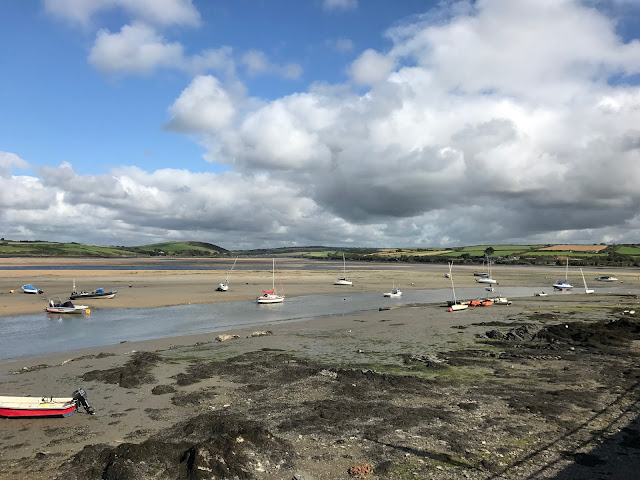
Camel Estuary from the Camel Trail, Padstow, Cornwall

The Camel Trail and Estuary, Padstow, Cornwall

Boats on the Camel Estuary from the Camel Trail, Padstow, Cornwall

Boats on the Camel Estuary from the Camel Trail, Padstow, Cornwall


Just outside Padstow is this wonderful iron bridge. Although sadly no longer carrying steam trains full of excited holiday-makers, or hauling trucks full of freshly caught fish, it has been converted into a recreational route for walkers and cyclists.

Iron bridge, Camel Trail, Padstow, Cornwall

The view from the bridge is quite stunning too.

Iron bridge, Camel Trail, Padstow, Cornwall

Iron bridge, Camel Trail, Padstow, Cornwall

Iron bridge, Camel Trail, Padstow, Cornwall

Iron bridge, Camel Trail, Padstow, Cornwall

The main reason for the bridge it would seem was to cross Little Petherick Creek.

Little Petherick Creek from the Camel Trail, Padstow, Cornwall

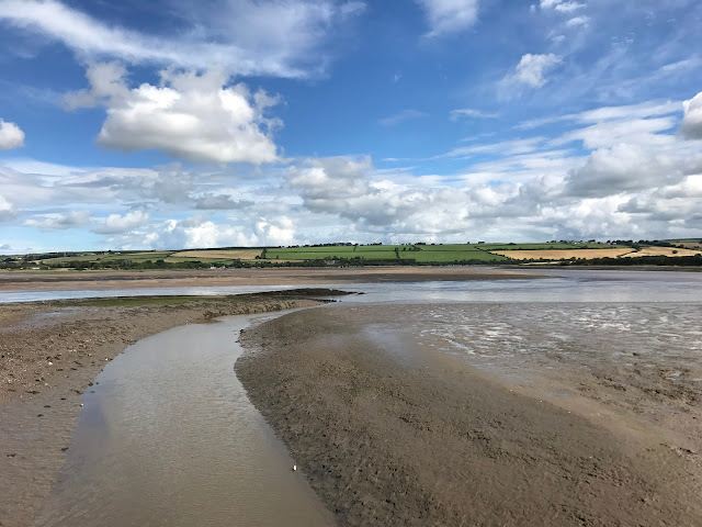
A little way outside Padstow beyond the iron bridge, at low tide the views both ways along the estuary open out into wide expanses of sand.

Camel Estuary from the Camel Trail, Padstow, Cornwall

Camel Estuary from the Camel Trail, Padstow, Cornwall

Camel Estuary from the Camel Trail, Padstow, Cornwall

Looking back towards the iron bridge on the Camel Trail, Padstow, Cornwall

Camel Estuary from the Camel Trail, Padstow, Cornwall


As usual, thanks for reading. Hopefully I'll get an opportunity for some more urban, suburban and coastal wandering over the coming weeks, with more posts to follow.

Tuesday, 2 January 2018

Wandering in and Around Bideford, Devon (part 2)

Happy New Year 2018. I don't really make New year's resolutions any more, but let's just say I have an intention to blog more than I did in 2017.

Following on from my previous Bideford post which covered a cycle ride along the Tarka trail, the second part will cover a few other aspects of Bideford, mainly the area to the east of the River Torridge, called East-the-Water. Once the only way to cross the river, this magnificent bridge is still in use today but fortunately the majority of the traffic is now carried by the Torridge Bridge (the A39) further to the north.

Old Bideford Bridge, Bideford, Devon

Looking north from the Old Bideford Bridge, the Torridge Bridge can just about be seen in the distance.

Looking north from the Old Bideford Bridge, Bideford, Devon

As we crossed the bridge to East-the-Water and wandered along the road, one of the first sights that greeted me was the wonderful ghost sign.

BRUNSWICK WHARF.
I. BAKER & SON
GENERAL BUILDING MATERIAL
&COAL MERCHANTS.


I. Baker & Son ghost sign in Bideford, Devon

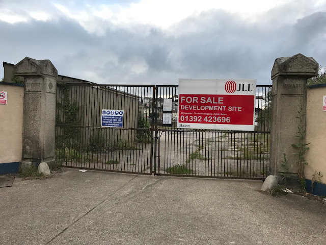
Just along from the Brunswick Wharf building was the site of another former wharf, Queen's Wharf. Ripe for redevelopment it still displays the Queen's Wharf name on the pillars either side of the gate.

Queen's Wharf, East-the-Water, Bideford, Devon


This next picture was taken from the Tarka Trail, looking down into East-the-Water, just to the south of the Old Bideford Bridge. Presumably these buildings were also parts of a former wharf, but now looking a bit worse for wear and adorned with street art.

Street art, East-the-Water, Bideford, Devon


Originally built as a Collar Factory, and later as a furniture store, the building still bears its name and purpose.

BLACKMORES DEPOSITRORY

Blackmore's Depository ghost sign, Bideford, Devon

After a very wet day, the skies cleared in the early evening as we made our way down into the town for dinner, treating us to some lovely cloud formations. This first picture is taken from the west side of the River Torridge.

Looking down towards the River Torridge from Bideford, Devon

Looking south from the Old Bideford Bridge, Bideford, Devon


Looking towards the River Torridge from East-the-Water, Bideford, Devon

Looking towards the River Torridge from East-the-Water, Bideford, Devon

Once again, not having kept a meticulous record of where I took my photos, and my memory failing me, I am really not sure where these next two pictures were taken. Given the date they were taken, I am very sure they are in and around Bideford, but exactly where I cannot tell. If I had to guess then I'd say they were taken from the Tarka Trail as we cycled along it north from Bideford to Barnstaple and Braunton.

Somewhere along the Tarka Trail, near Bideford, Devon

Somewhere along the Tarka Trail, near Bideford, Devon


Thanks for reading. This is the last of the two posts I'll be doing on Bideford. I still have some archive material from last summer to post, so that will probably feature next, but hopefully I'll get an opportunity to explore more this year and post accordingly.


Related Posts Plugin for WordPress, Blogger...